Create a Surface
|
| Main Page | Data Collection | Figures | Description Keys | Data Collection Link | Import a fieldbook | Create a surface |
Overview:
|
|
It is possible to structure the Description Key file in such a way that all points to be used in creation of a surface fall on a single layer. A simple selection set can then be used to add all points to the surface. If this is not the case you can also add points by selection or point number. Additionally, if you use field connectivity codes to create automated linework, those figures contain references to the points that created them. One command can then be used to create all the breaklines for your surface at once. |
Create a
Point Group of the Surface Points
|
| You can type “ss” and create a selection set to make building a point group easier. You need a point group or list to add points to a surface… |
|
|
|
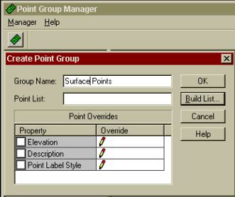
Click on Manager and Create Point Group |
|
|
|
Enter a name and click Build List… and click
“Advanced” then you’ll see the following screen… |
|
|
|
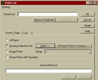
Click Drawing Selection Set and Select<< If you sent your surface points to a layer and prepared a
selection set type “P” for previous, otherwise select the points to be
used in the surface. You may
also use any of the other available filtering methods available. Please refer to your LDD manual regarding point groups for
further details. |
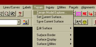
To create a surface (Terrain menu): |
|
|
|
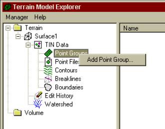
Click Manager and “Create Surface”, a surface with a default name will be added. Click the “Plus sign” to expand the surface data. Right click on “Point group” and click “Add Point group…” as follows: |
|
|
|
Select the point group or list you
created. To
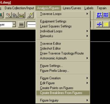
create auto-breaklines from the figures created by the field book (from
the Survey menu): Once you have created a surface you can return to the Survey menu and create breaklines from the figures you imported from the field book… |
|
|
|
You can either choose “ALL” or
“SELECT”. Your faults
will be created but will not have elevations assigned to them until you
build the surface. Tip: If you use the “ALL” option
you may have to delete those faults that should not be part of the surface
(utility lines or treelines or walls for example) |
|
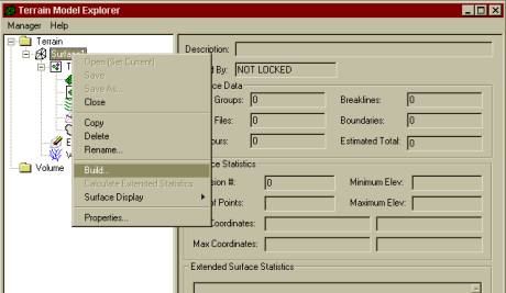
To build the surface (in the Terrain Model Explorer outlined above): |
|
Right click on the surface name and click Build… |
|
|